 I love maps. You look at an Ordnance Survey Landranger map and you see a thousand years of history, of exploration, of society, of geography all in single sheet of paper that you can fold up and put in your pocket. GPS gives you directions but a map gives you a world.
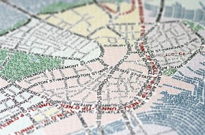
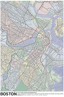
Consequently, I was fascinated and delighted to see these typographic maps from Axis Maps. Currently only available for Boston and Chicago, every feature that you’d expect to see has been created using just type. So for roads and highways, you have a ribbon of text made from the street’s name. The names of neighbourhoods fill in the blocks as subtle shading. Trains and subways are picked out in the name of the line.
 It’s taken the team at Axis Maps over two years to create the city maps – the idea started with a University of Wisconsin party invite – and the whole process is covered on their blog, along with lots more images. They started with OpenStreetMap images and then carefully added text over the feature areas. There was also great deal of copy’n’paste but the end result is worth it.
If you do go over to their website, click on some of the thumbnails – you’ll get a pop-up that expands and zooms the detail.


The maps are available to purchase – $30 gets you a 2ft-ish x 3ft-ish print. UK dwellers can purchase from zazzle.co.uk – just search for Axis Maps. I’ll be ordering Chicago shortly.
All images copyright of Axis Maps LLC.
