Tag Archives: Map

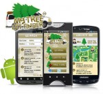
My Tree Lot Finder: Find Your Perfect Christmas Tree


My Tree Lot Finder
My Tree Lot Finder

Looking for that perfect holiday tree? The lots seem to pop up within 24 hours of Thanksgiving. But which one do you go to?

A new application has hit the Android market. My Tree Lot Finder ™ can help you find the best tree lots; those “Mom and Pop” lots that use quality trees for best selection. That way, you don’t have to search for hours to find that perfect tree.

The app helps you not only save time and money by locating the perfect tree, but also gives you care instructions for your new purchase. That way, if you are a N00b when it comes to trees, you don’t have to act like one.

“Have you ever headed out after dark to find that perfect tree?  Kids in tow?  The first lot you go to had nothing but dead and dried trees,” says Wayne Irving II, creator of My Tree Lot Finder. “ Wouldn’t it be nice to know where the next tree lot to you is?  So you are not driving further than you have to?”

You can search trees by Zipcode or just scour the map within the app. Target a lot and get driving directions. It will also let you know where the tree farms are and where the non-profit lots (like Boy Scouts, fund-raising lots, etc) are located.

Some lots also have other amenities, such as selling ornaments or if the tree farms have other cool events like hay or pony rides, if they also offer things like Yule logs, wreaths or more.

The application is only available for Android at this time. The parent company – Iconosys – is a member of the National Organization for Youth Safety (NOYS).


Ofcom Sitefinder Mobile Phone Mast Map


Ofcom, the independent regulator and competition authority for the UK communications industries, hosts a database, called Sitefinder, giving the location and type of mobile network base stations. Why would you be interested in base stations? Because they’re another names for mobile phone masts or cell phone towers.

The database has been linked with the ubiquitous Google Maps so that by entering a post code or a street address, the area of interest can be shown, with markers indicating the exact locations of the towers. By clicking on the marker, you can see the operator of the tower, what kind it is, the height and the frequencies used.

91% of UK adults have a mobile phone, so it’s not surprising that there are lots of cell towers. You could use this database in two ways. First, if you have concerns about health issues relating to the radio waves you can be more informed about the towers in your area, but secondly, if you are trying to decide which mobile phone operator to use, this map will show you the closest towers to home and work and likely to give the best reception.


Interactive New Zealand Earthquake Map


An interactive map, called the Canterbury Incident Map, is online providing information for victims of the recent Christchurch, New Zealand earthquake.  The clickable map gives information on what bridges are open, water distribution centers, road closures, aftershock locations, supermarket locations, and more.

The map also provides some insight for the rest of the world by displaying geotagged Flickr photos and YouTube videos.  It’s another example of a great use of modern technology.  It is providing crucial information for local residents as well as showing all of us exactly what the situation on the ground there is.  The latter is also helpful for those looking to provide aid to the area.